Want To Time-Travel? This Map Exhibit Lets You Do Just That
Image source: Murillo Velarde, Pedro, and Nicolás De La Cruz Bagay. Carta hydrographica y chorographica de las Yslas Filipinas: dedicada al Rey Nuestro Señor por el Mariscal d. Campo D. Fernando Valdes Tamon Cavallo del Orden de Santiago de Govor. Y Capn. [Manila: Publisher Not Identified, 1734] Map. https://www.loc.gov/item/2013585226/.
The rhubarb conundrum, as seen in these maps and illustrations
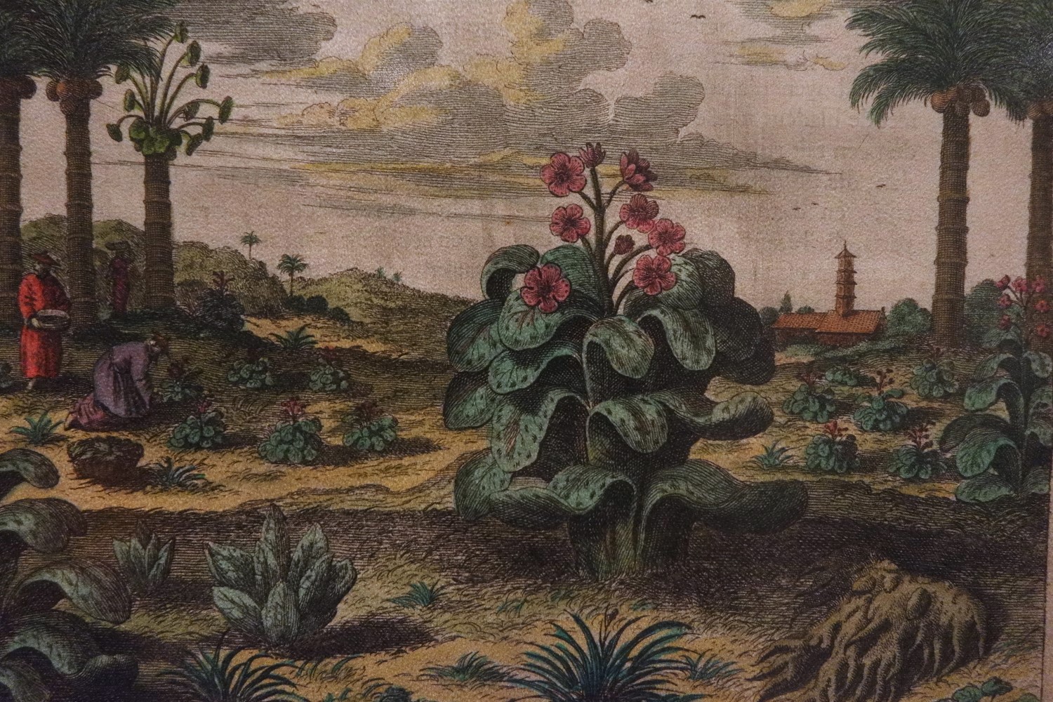
On one of his exploits around the world, Italian merchant Marco Polo made a grand discovery that would have taken the medicinal world by storm: the rhubarb plant, which was, at that time, considered a precious cure for constipation and can also act as a laxative, depending on the dosage. It was, Polo proudly declared, found in the markets of Succuir in Tangut. Unfortunately, the famous explorer had no proof of what it looks like, nor did he have any skill in cartography to point out exactly where in the world Tangut is. His grand discovery was, essentially, useless.
The then illustrious rhubarb
There were many attempts to locate the plant, but Western cartography was no Google Maps back then. Hence, a lot were misled about the rhubarb’s actual location. It took three centuries before this wonder plant was accurately located—in China, specifically in Jiaquan, Gansu in Western Xia.
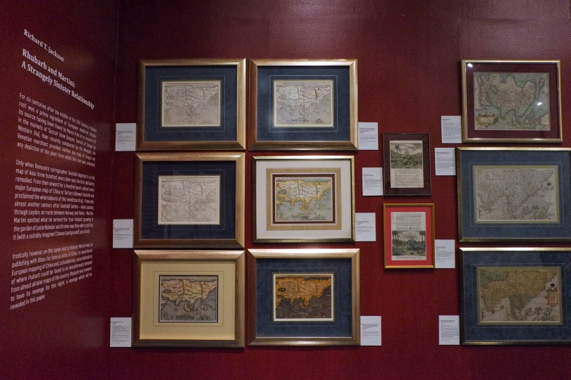
This historical tidbit is one of the many interesting facts you’ll discover in Ayala Museum‘s Insulae Indiae Orientalis, an exhibit that showcases the curious world of cartography. The show is in partnership with The International Maps Collectors Society (IMCoS) and the Philippine Map Collectors Society (PHIMCOS).
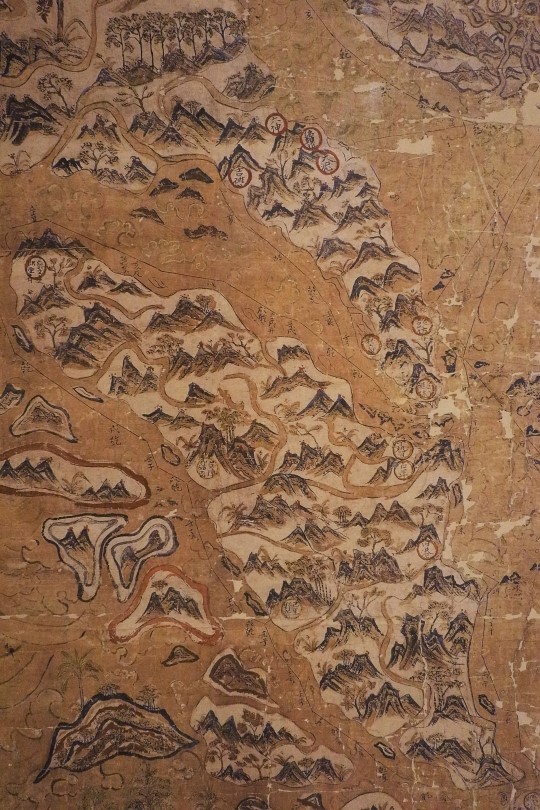
This Chinese maritime map dates back to the Qing Dynasty in the 18th century. This map is centered on the Pearl River Delta, and is divided into 12 sections that represents the 12 directions of the compass.This “Selden map” from China is a hanging scroll done in ink and color on paper
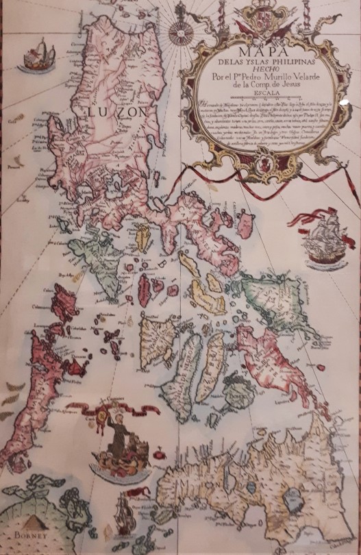
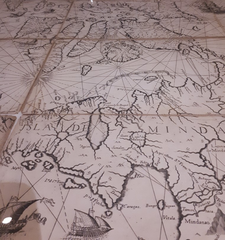
On display are more than 150 original maps and prints, including some original copper-engraved drawings that date as far back as the 16th century. The spotlight is on the Murillo Velarde map drawn by the Jesuit Father Pedro Murillo Velarde in 1734. Dubbed as the “Mother of all Philippine Maps,” it played a crucial role in the Philippines’s arbitration case against China concerning the highly disputed Spratly Islands in the South China Sea/West Philippine Sea.
The hand-colored engraving of the Murillo map done on thick paperThe copper-engraved and sectionalized Murillo Verlarde map, which was one of the three references used in the South China Sea/West Philippine Sea arbitration.
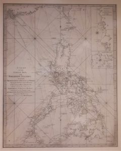
Also worth scrutinizing is the “Chart of the China Sea and Philippine Islands with the Archipelagos of Felicia and Soloo” done in 1794. The detailed cartography shows two fascinating historical events: in 1740, Austrian Commodore George Anson attacked the Spanish Galleon Nuestra Senora de Cabadonga, which carried precious cargo; and the tragic voyage of The Royal Captain, an East India ship that sailed in 1772. It sank in the uncharted waters of the South China Sea/West Philippine Sea. Two centuries after, in 1995, an expedition led by French archaeologist Franck Goddio located the wreck of The Royal Captain some 76km off Palawan.
The Chart of the China Sea and Philippine Islands, which shows the ill-fated voage of The Royal Captain, as well as the battle waged by Commodore George Anson against Nuestra Senora de Cabadonga
While these maps are now inaccurate and are only displayed for posterity’s sake, their importance cannot be overstated. Cartography, after all, goes beyond navigation—it allows us to take a peek at history, and can even be key to resolving territorial disputes (the still highly contentious West Philippine Sea arbitration notwithstanding). And, as Marco Polo might have already known by now, maps can even help find immediate cure to irregular bowel movement.
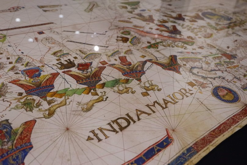
Cartography in the past centuries are done in painstaking detailsInsulae Indiae Orientalis runs until October 28, 2018. Entrance is at P150.
Pushpins is a GIS company based in the Philippines. For more information, log on here.